Object detection
Last reviewed: 2026-07-07.
Object detection goes a step beyond classification: it finds where objects are in an image and draws a labelled box around each one. In African contexts it powers tasks like counting livestock from drone imagery, spotting infrastructure in satellite photos, or locating individual plants in a field.
What the data looks like
A detection dataset is images annotated with bounding boxes, each box marking the location and class of one object. The annotation is far more laborious than classification, since every object in every image must be boxed, which makes tool choice and clear guidelines matter more. African detection data is dominated by aerial and satellite imagery for agriculture and the environment, where boxes mark fields, buildings, or vehicles, and by wildlife and livestock monitoring. As with classification, images captured in real African conditions, low resolution, oblique angles, dense scenes, are essential, because models trained on clean benchmarks degrade on them.
The most widely supported format is COCO, where one JSON file holds the images, the boxes, and the categories, linked by id. Each box is [x, y, width, height] in pixels from the top-left corner:
{
  "images": [
    {"id": 1, "file_name": "field_0007.jpg", "width": 1280, "height": 720}
  ],
  "annotations": [
    {"id": 1, "image_id": 1, "category_id": 1, "bbox": [340, 120, 85, 110], "area": 9350, "iscrowd": 0}
  ],
  "categories": [
    {"id": 1, "name": "cattle"}
  ]
}
COCO is worth using even for a small African dataset, because the evaluation tools below read it directly, so you avoid writing a custom parser and your results stay comparable with everyone else reporting mAP.
Annotation and evaluation
Box annotation needs explicit rules: how tightly to fit the box, how to handle occluded or overlapping objects, how small an object must be to mark, and what to do at the image edge. These rules are where annotators silently diverge, so pin them down and measure agreement on a shared set. Detection is evaluated with mean Average Precision (mAP), which rewards both correct labels and accurate placement, built on Intersection over Union (IoU), the overlap between a predicted box and the true one. Report the IoU threshold you used, since mAP at a loose threshold flatters a model that places boxes sloppily.
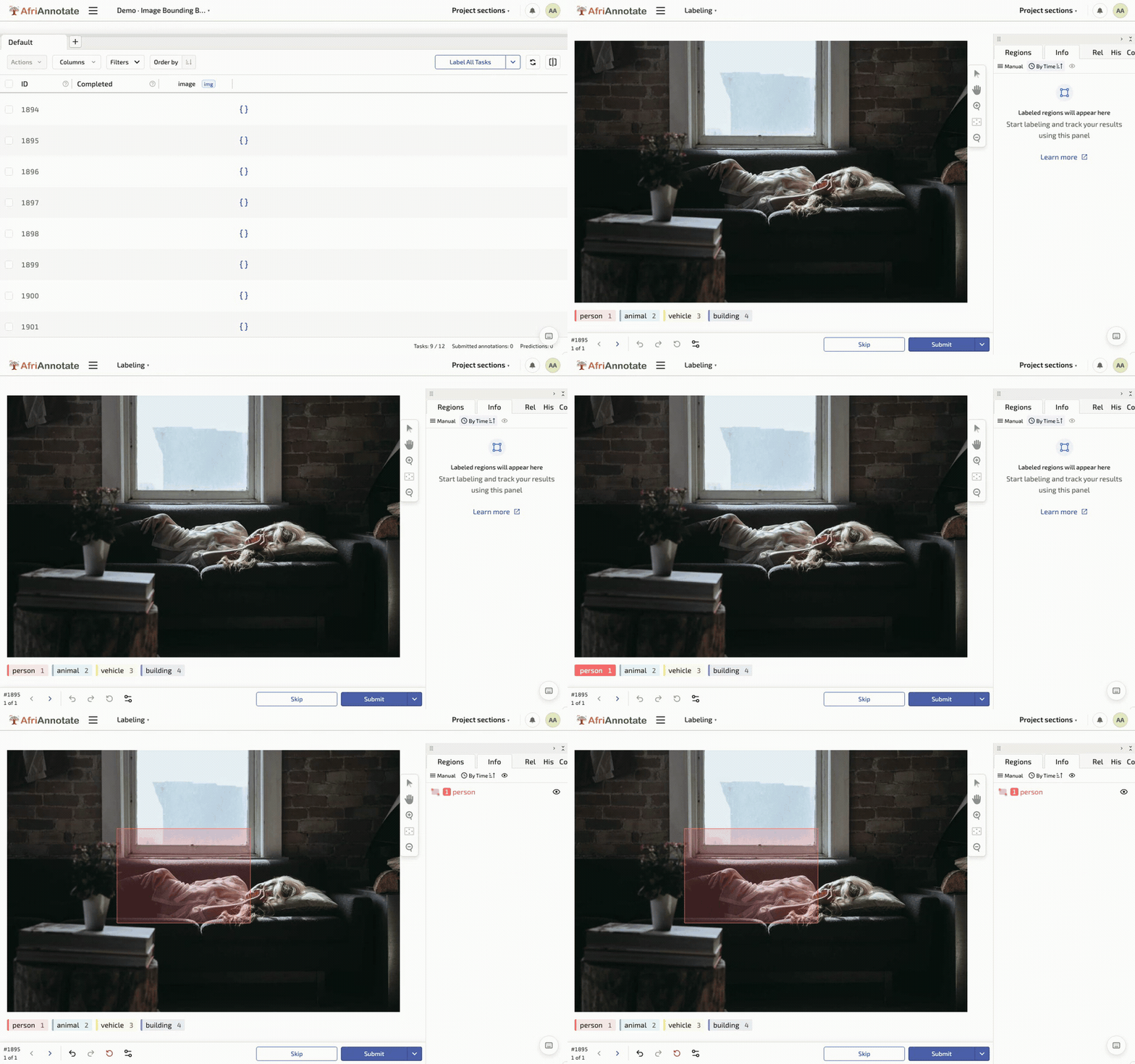
The labeling config gives the annotator a set of box labels to draw over the image:
<View>
  <Image name="image" value="$image"/>
  <RectangleLabels name="bbox" toName="image">
    <Label value="Cattle"   background="#C66A3D"/>
    <Label value="Building"  background="#1F5B3F"/>
    <Label value="Vehicle"   background="#E0A458"/>
  </RectangleLabels>
</View>
torchmetrics computes mAP from predictions and targets, and reads the IoU threshold straight off so you can report it honestly:
# pip install torchmetrics
import torch
from torchmetrics.detection import MeanAveragePrecision

# Boxes here are [x_min, y_min, x_max, y_max]; convert from COCO's
# [x, y, w, h] with x_max = x + w, y_max = y + h before scoring.
preds = [{"boxes": torch.tensor([[340.0, 120.0, 425.0, 230.0]]),
          "scores": torch.tensor([0.92]),
          "labels": torch.tensor([1])}]
target = [{"boxes": torch.tensor([[342.0, 118.0, 427.0, 232.0]]),
           "labels": torch.tensor([1])}]

metric = MeanAveragePrecision(iou_thresholds=[0.5, 0.75])
metric.update(preds, target)
result = metric.compute()
print(f"mAP@0.50: {result['map_50']:.3f}")
print(f"mAP@0.75: {result['map_75']:.3f}")  # stricter: punishes loose boxes
The gap between the two thresholds is the useful read: a model that scores well at 0.50 but poorly at 0.75 is finding the right objects but boxing them loosely, which matters when the box itself carries the measurement, such as counting tightly packed livestock or delineating a field.
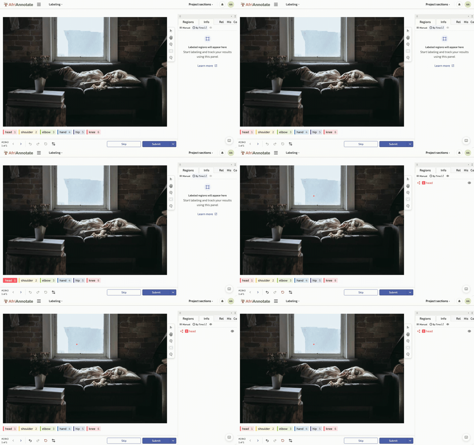
Drawing a box, and placing keypoints, in the AfriAnnotate editor:
The 2026 modelling landscape
Object detection in 2026 is dominated by transformer-based detectors and open-vocabulary detectors. The workable open-model references:
- RT-DETR / RT-DETR v2 (Baidu, 2023-2024): the real-time DETR variant, Apache-2.0 licensed, competitive mAP with substantially better inference latency than YOLO-lineage detectors. The defensible default for a new African-context detection project.
- Co-DETR and DINO-DETR: the strongest current closed-vocabulary DETR variants for accuracy at the cost of inference speed. Useful when accuracy dominates deployment cost.
- YOLOv10 / YOLO11 / YOLO12 (Ultralytics, 2024-2026): the widely-deployed YOLO lineage, AGPL-3.0 licensed (commercial deployments require an Ultralytics licence). Still the workable default for edge deployment where inference speed dominates. Note the licence caveat before committing to production.
- Open-vocabulary detectors. Grounding DINO (IDEA-Research, 2023), OWLv2 (Google, 2023), YOLO-World (Tencent, 2024): detect arbitrary categories from natural-language prompts without a fixed training vocabulary. Useful when the deployment surface has a growing or long-tail category set.
- General MLLMs with detection. Qwen2.5-VL and Molmo produce bounding-box output from natural-language prompts; workable when the detection is one part of a larger multimodal task, weaker than dedicated detectors on pure-detection benchmarks.
Editorial opinion. For a new African-context detection project (agriculture, environment, wildlife, infrastructure), the shortest defensible path is: fine-tune RT-DETR v2 on 2,000-10,000 annotated target-domain images, evaluate mAP at IoU 0.50 AND 0.75 (report both), and report per-class AP alongside the mean. For edge deployment, distil to a YOLO11 or MobileNetV4-based detector after training. For long-tail or growing vocabularies, evaluate Grounding DINO zero-shot before committing to a closed-vocabulary detector.
What it will actually cost you
Detection is 3-10x more expensive per-record than classification because every object in every image must be boxed, and adjudicating box tightness across annotators is slow. Rough order-of-magnitude:
- Fine-tuning RT-DETR v2 or YOLO11 on an existing detection corpus. One to three person-weeks; twenty to a hundred GPU-hours.
- Building a new detection corpus for an African-context task (2,000-10,000 images with 5-30 boxes per image). Six to fifteen months elapsed; six to fifteen person-months. Box-tightness adjudication is the constraint; a corpus with strict box-fit rules costs 30-50% more than one with loose rules.
- Extending to keypoint annotation on top of boxes. Add 50-100% to annotation effort per image.
- Evaluation-only detection sets (500-2,000 images). Three to six months; three to six person-months.
- Satellite / drone-imagery annotation. Faster per-object (small objects on aerial imagery) but requires GIS-familiar annotators: a smaller pool than classification-annotators and typically higher hourly rates.
- Human evaluation of detection output. Two to three person-weeks per evaluator per 200 images. Detection evaluation is slow because the evaluator must check both class correctness and box-fit correctness.
Known limitations to watch for
- Report mAP@0.75, not just mAP@0.50. A detector that scores well at 0.50 but poorly at 0.75 is placing loose boxes. If your downstream task uses the box for measurement (counting, area estimation, cropping for downstream classification), loose boxes destroy the downstream signal.
- Small-object performance is the hidden failure. Aerial and satellite imagery is dominated by small objects; most detectors trained on natural-imagery benchmarks under-perform on small objects. Report AP by object size (small / medium / large) as separate numbers.
- Class imbalance in the same imagery. A field-imagery corpus with 1,000 healthy plants and 5 diseased plants per image trains a detector that ignores the diseased class. Rebalance during training (oversampling, class-weighted loss) or accept the failure.
- Dense-scene occlusion. Livestock counting, market-scene detection, and crowd analysis all involve dense scenes where objects occlude each other. Standard detectors under-perform in dense scenes; report crowd-scene AP separately.
- Confounded backgrounds. If all photos of the diseased class were taken in one field and all photos of the healthy class in another, the detector learns to distinguish fields, not classes. This is the object-detection version of the classification confound.
- Satellite-imagery seasonality. A detector trained on rainy-season satellite imagery of maize fields fails on dry-season imagery. Multi-seasonal training data is not optional.
- Consent and identifiability at aerial resolution. Drone imagery of a village at 5cm/pixel resolution shows identifiable people, homes, and possessions. Regulatory frameworks vary by country; the data governance chapter covers the discipline.
- Licence caveat for YOLO lineage. YOLOv5, v8, v10, v11, v12 are AGPL-3.0. Commercial deployment requires an Ultralytics licence. Check before shipping.
Further reading
- RT-DETR v2 (Lv et al., 2024): the workable real-time DETR-lineage detector; the defensible default for African-context detection projects.
- Grounding DINO (Liu et al., 2023): the workable open-vocabulary detector; useful for long-tail or growing category sets.
- State of CV in Africa (2024): the reference survey of the field on the continent; useful for understanding where detection sits among the African CV corpora.
Additional references
- YOLO11 (Ultralytics, 2024): the widely-deployed YOLO lineage; note the AGPL-3.0 licence.
- OWLv2 (Minderer et al., 2023): the Google open-vocabulary detector.
- YOLO-World (Cheng et al., 2024): real-time open-vocabulary detection.
- Co-DETR (Zong et al., 2022): the strongest current DETR variant for closed-vocabulary accuracy.
- COCO (Lin et al., 2014): the reference detection benchmark; useful for calibration and cross-corpus comparison.